Papua New Guinea’s Sudden Tsunami Warning Sends Shockwaves Through New Britain
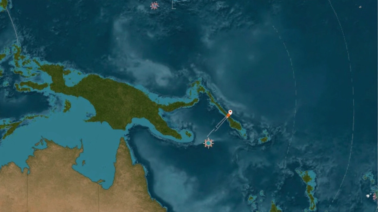
In the early hours between April 4 and 5, 2025, the ground shook violently off the coast of New Britain, Papua New Guinea. The earthquake’s magnitude—measured at 6.9—was enough to trigger immediate action from authorities and set off a chain of alerts across the region. People living in Kimbe and along the nearby coastline, a population of more than 500,000, waited anxiously for updates as the scenario threatened to spiral into a disaster.
This quake wasn’t your everyday tremor. The U.S. Geological Survey pegged the quake’s focus at just 10 kilometers deep—a shallow quake, which usually packs a harder punch at the surface. The European-Mediterranean Seismological Centre saw it differently, estimating a depth of 49 kilometers, highlighting how different data sources interpret quake details with their own tools and models. But on the ground, these technicalities mattered less than the looming threat: a potential tsunami rolling in from the sea.
The epicenter sat 194 kilometers east of Kimbe, a busy regional hub on New Britain Island. Officials passed along initial warnings for tsunami waves between 1 and 3 meters high that could hit the Papua New Guinea coastline. What might seem modest on paper is absolutely devastating for lives and infrastructure—especially in a region where many rely on the ocean for travel, food, and trade. To the east, residents of the Solomon Islands were told to prepare for smaller waves, less than 30 centimeters high, but still enough to disrupt small ports and vulnerable beach communities.
As tense hours ticked by, authorities monitored the sea for any changes. Reports of unusual sea behavior trickled in. But soon, the alerts were canceled—the tsunami threat had faded as quickly as it appeared. Meteorological and disaster agencies breathed easier, confirming no significant tsunamis had formed. Australia and New Zealand, much further away, checked their own monitoring stations and reassured the public there was no threat to their coastlines either.
A Constant Threat Along the Pacific Ring of Fire
Still, moments like this keep the reality front and center for anyone living in Papua New Guinea. The country sits right on the edge of the Ring of Fire, a stretch around the Pacific Ocean where a tangled web of tectonic plates meet, wriggle, and sometimes clash in ways that shape the landscape and threaten lives. It’s not just earthquakes—they face the added risk of volcanic eruptions, tsunamis, and landslides. In a country where communities are often only accessible by boat or bush track, even a false alarm can spark confusion, fear, and displaced families.
For locals, the scare threw routines into chaos for a few hours, but it also showed that emergency alert systems moved quickly, with information spreading from seismologists to officials, then out to the fishermen, market vendors, and families who needed it most. No reports of injuries or damage came in, but disruptions in the sea and local harbors reminded everyone just how fast circumstances can change when the earth moves in this part of the world.
This quake may have ended quietly, but it rattled nerves and woke up old fears—a reminder that for Papua New Guinea, living on the Ring of Fire means staying alert is just a fact of daily life.